


No products in the cart.
Return To Shop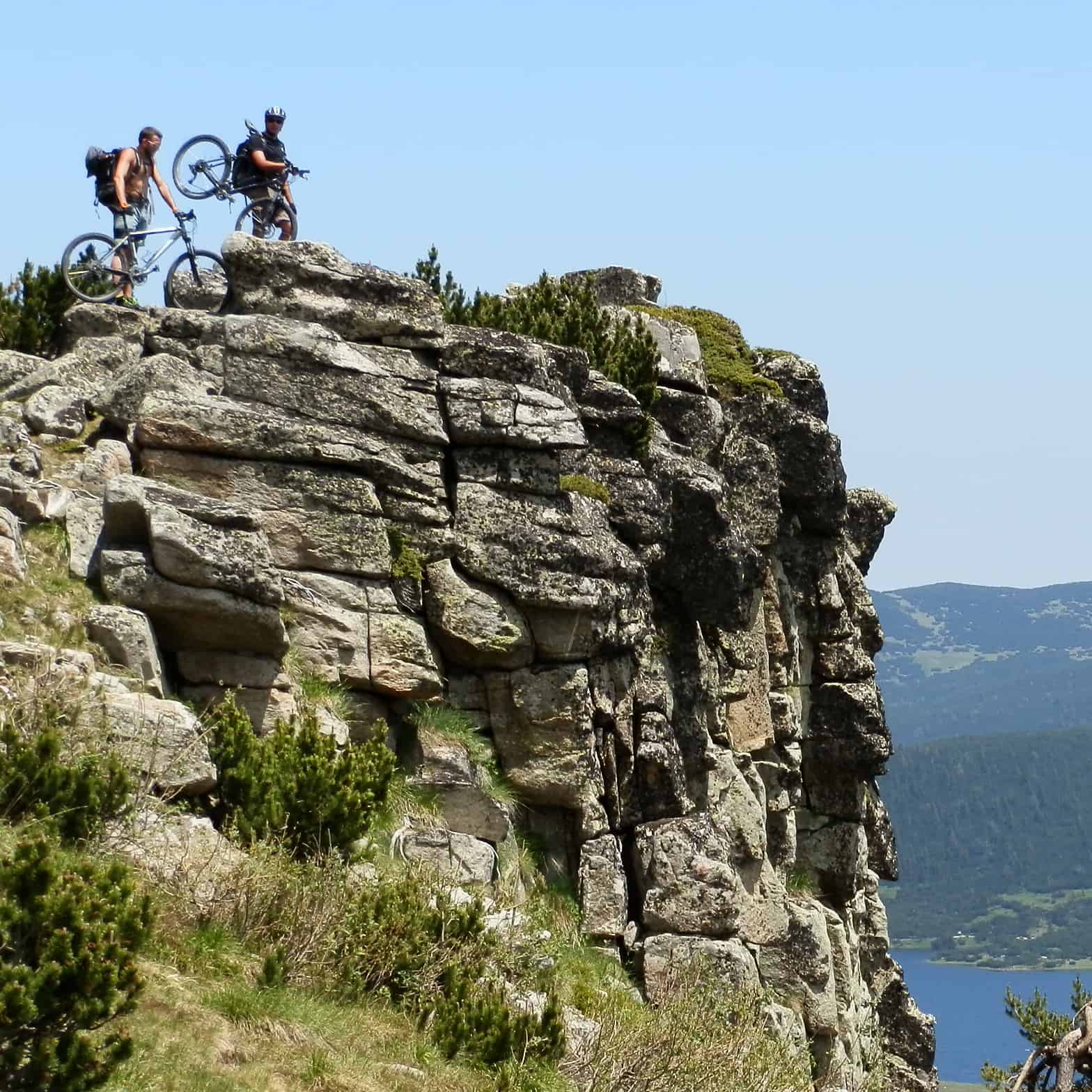
Bansko is a town in Southwestern Bulgaria, located in Razlog Hollow, at the foot of the northern slopes of Pirin Mountains. It is a well-known ski destination – the ski zone of Bansko is actually the most modern and biggest one in Bulgaria. For 3-4 months in winter everything is focused on the ski area and skiing. But there is much more beyond that in Bansko – and most visitors do miss out on experiencing it.
Razlog Hollow is surrounded by the main mountain ranges of the country – Rila, Pirin and Rhodope mountains. All of them are easily accessible from Bansko and offer different landscapes, terrains and challenges for the mountain bikers. Once you go out of the mainstream tourist zone of Bansko, you’ll get impressions of the real country Bulgaria – with its local population, wild nature and beautiful mountains.
Pirin Mountains with their rocky, jagged peaks always instill respect in the first-time visitor. Mountain biking on such terrain seems mission impossible. Despite that, there are numerous options. One can use the advantage of the ski lifts of Bansko and Bezbog ski zone and do some more technical single tracks or choose smoother tracks that go around the mountain between the villages at the foot of it.
Rila Mountains, especially their south slopes that look towards Pirin, are a great terrain for demanding xc biking. The lower parts are easier, they have a good network of dirt roads that connect the villages and some other interesting locations like the Belitsa Dansing Bears Park. The high parts of the mountains are accessible along a couple of paved roads. For the experts or just for the real adventurers there are a couple of epic 2-day routes that climb and cross the whole mountain from south to north – the so called “Kaizer’s Route” from Yakoruda to Borovetz and the route to Rila Monastery via Makedonia Hut.

Meeting other cultures
The nearby parts of Rhodope Mountains offer the smoothest terrain, the greatest views towards the other mountain ranges as well as the most thrilling interactions with locals. Our favourite day trip includes an early jump into the narrow gauge train that goes between Rila and Rhodope mountains, finally up to the highest rail station on the Balkans. Some nice sandy roads take us on a tour to the isolated villages of Velijski Rodopi region until we finally descend down to the hollow and visit some of the nice mineral pools in the area. Multiday trips would include biking through the green forests of the endless Rhodopes, around the blue dams of Dospat, Batak and Beglika, or even further to the famous Trigrad area.
This article aims to give a common view and some ideas about mountain biking in Bansko area. The options for day and multyday trips are numerous and we’ll be happy to offer you a detailed itinerary according to the season, your timeframes, level and preferences. Some itineraries are available at What to Do/Mountain Biking section of the website. Bike hire is also available.
Here are some of our suggested itineraries, all of them can start from Bansko:
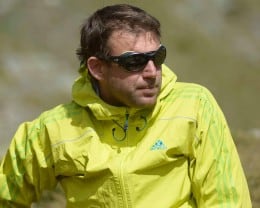 My name is Lyuben Grancharov, I’m a qualified Bulgarian mountain bike leader and I live and work in Bansko. If you have any questions about mountain biking around Bansko or you need a guide, do not hesitate tо contact me.


Related posts

The towering Rila Mountains, situated in Bulgaria are the highest mountain range on the Balkans. The central and lofty parts of them are occupied by the... Continue reading

Mountain Rescue and Travel Insurance Mountain Rescue services are paid in Bulgaria and the best way to cover such expenses is to have a valid... Continue reading

2023 up to date information on the working hours and operating schedule of the main lifts of Rila, Pirin, Vitosha and Balkan mountains in Bulgaria.... Continue reading

Vitosha is a wonder, a nature wonder! Being so close to Sofia, it’s a remarkable destination for all citizens and visitors and one of the... Continue reading

Northern Pirin Mountains – info on how to get by public transport to the main starting points for hiking or trekking in this mountain range.... Continue reading

Add comment