Rhodope Mountains
Trigrad Gorge and Devil’s Throat Cave
The Village of Kovatchevitsa
The Magical Village of Gela
Slivodolsko Padalo Waterfall
Vultures and Legends in Madzarovo
Bachkovo Monastery
Belintash Rock Formation
Rhodope Mountains
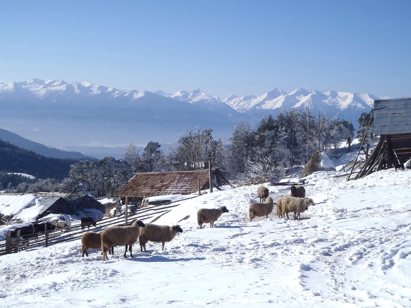
Some people use to call it “Mother Rhodopa”. These mountains have a completely unique image in the Bulgarian’s minds during the ages. Rila and Pirin were the high, jagged, airy, cold and severe mountains, where it was possible to live during the summers only, if you are a tough nomad, but not the winters. The Rhodopes, despite their mountain climate and difficult terrain, are seen as a Shelter. They are a place to hide, to spend your life and earn your living. Inhabited for many centuries, these mountains saw all the fights and conflicts that happen in the area, they saw many different populations who crossed their territory, but it was always calmer and safer up the mountains, it was always a more sheltered place for the pupil.
The mountains have been inhabited since the times of the Thrachians and are quite populated nowadays. They are also known as “The mountain of Orpheus”. Orpheus is the famous musician in the Greek Mythology, who had Thracian origins. He was considered the best singer and poet of the Antiquity. It is considered that he was born here, in these mountains, as the Thrachian tribe of the Besi lived here. The name of the Rhodopes (known as Rodopa in the past) has same ancient origins. Herodotus mentioned it for the first time at 5-th century BC. According to a famous Thrachian legend, mentioned by Ovidius, Rhodopa and Hemus (the ancient name of Balkan Mountains) were brother and sister, who fell in love with each other. They started calling each other Zeus and Hera. The other Gods did not accept their relationship and converted them into mountains – the Balkan and the Rhodopa, which stand against each other, separated by the valley, forever.
Symbol of these mountains is the flower, which is seen only in this region – the Rhodopean Silivryak (Haberlea Rhodopensis). It is also famous as the flower of Orpheus. The Silivryak is an endemic plant that lives on the Balkan Peninsula and also a protected Relict flower. It is known with its resistance to lack of humidity and it is considered that it can be brought back to life even if dried for a long time, even years.
Walking in Rhodopes – of course, in such a big area the opportunities are endless. The trails here are “easier” – softer ups and downs, not many rocky sections along the way. There are also a lot of dirt paths that connect the villages. Rhodopes are great for mountain biking, too. There is an extensive network of mountain trails and huts, but thesehaven’t been maintained well since Communist times. The result is that some huts are abandoned, others are in a very poor condition, also many of the trails are not in a good condition. Actually most hikers would prefer to stay in a local guest house in the nearby village, as, in addition to the roof on your head, you get a chance to experience the hospitality of the locals and try some traditional food.
The trails network is vast, some of the most popular multiday routes are: along Chernatitsa Ridge, the Gela-Mugla-Trigrad-Yagodina Trail, hiking the Perelik Ridge, hiking in the area of Belintash. One of the European Long Distance Walking Routes crosses Rhodope Mountains – the E8 Rila-Rhodopes Route – but the trail is not well-marked and maintained. In addition to that the existing maps of the area are scaled 1:100 000. All this makes the navigation in the Rhodopes a bit tricky task, more than in Rila and Pirin. The hiking season is longer than in the higher Bulgarian mountains and starts from March-April in the lower parts or May in the higher ones, until October-November. In winter, snowshoeing trips are possible between January-March in the high parts of Western Rhodopes – Gela, Perelik Ridge, around Pamporovo, Chepelare, etc.
Additional Info:
- Trekking, snowshoeing and mountain biking itineraries in the Rhodopes.
- Map of Western Rhodopes
- Map of Eastern Rhodopes
More about the Rhodopes – they are the 7th highest mountain range in Bulgaria. The mountains are with a very complicated structure, an extensive network of separated ridges and deep gorges, covered by green meadows and the largest coniferous woods on the Balkans. They miss the alpine relief – jagged peaks and glacial lakes – of Rila and Pirin mountains. It’s a fact that this area was not covered by ice during the last Ice Age. Despite that, some parts of it are famous with their rock formations and caves, result of their Karst structure. The most popular among these sights are the Trigrad Gorge and Devil’s Throat Cave, Jagodinska and Snezanka caves.
Rhodope Mountains are part of the oldest landmass on the Balkan Peninsula – the Rilo-Rhodope Мassif, which includes also Rila and Pirin Mountains, and a few smaller mountain ranges.They are stretched at about 15 000 square kilometres, with about 90% of them located in Bulgaria and remaining 10% in Greece. That makes it the most extensive mountain range in the country, situated in the southwest parts of Bulgaria. Geographically the mountains are spread in two parts – Eastern and Western. Western Rhodopes are higher and larger (about 66% of the whole territory) than the eastern part. The highest point is mount Golyam Perelik (2191 m.), second highest is Mount Karluk (also known as Mount Orpheus). Both are located in Western Rhodopes and are part of the ridge Perelik, situated near the famous ski resort of Pamporovo and Gela Village. The highest point of Eastern Rhodopes is Veykata Peak (1463 m), which is part of the ridge of Gymurdzinski Sneznik. The ridge determines the border with Greece and Veykata is also the most southern point of the country.
The climate varies a lot, determined both by the cold northern air masses and the milder Mediterranean climate. The average annual temperature in the Eastern Rhodopes is 12–13°C, the maximum value of precipitation is in December, the minimum is in August. In the Western Rhodopes, the temperature varies with 5° to 9°C and the summer rainfalls prevail. The micro climate of some areas like the spa town of Devin is very mild and hardly any snow remains there for a long time, but just about 20 kilometres away the biggest Rhodopean ski resort of Pamporovo is located, with a heavy snow cover present for most of winter.
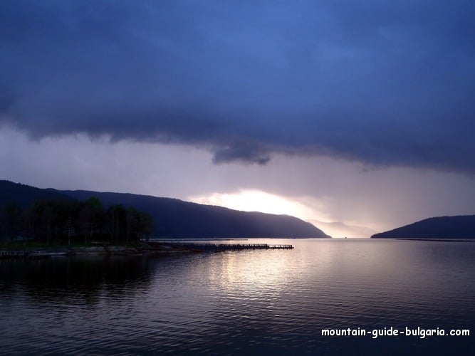
Water resources – the Rhodope Mountains have rich water resources. Although the many rivers and springs, a network of dams, built for hydro power purposes, exist – some of them are connected to each other by underground pipes and collect huge amounts of water. These artificial structures fit very well into the landscape and are popular tourist destinations. Most popular amongst them are Krichim, Batak, Dospat and Beglika dams in Western Rhodopes and Kurdzali and Studen Kladenec in Eastern Rhodopes. Thermal water sources can be found all over the mountains, some of them used for recreation in the towns of Velingrad and Devin, and smaller villages like Narechen, Beden and others.
The population is mixed – Bulgarians, who practice Orthodox Christianity, Bulgarian Muslims and ethnic Turkish Muslims – remnants from the past when Bulgaria was part of the Ottoman empire for about 500 years. Nowadays Rhodopes are a place famous with the hospitality of the people, the multicultural integration and the tolerance between the different religions. Because of the average high altitude not so many crops can survive here – mainly potatoes and tobacco in the east parts. Livestock breeding and forestry are the other main occupations for the locals. Mining used to be the most developed industry in the Rhodope with less and less importance in the last decades. There are many small villages and towns spread around the territory. Main towns are Smolyan, Asenovgrad, Dospat, Devin, Velingrad (the latter two are rich in mineral springs and famous spa-centres) in Western Rhodopes and Kurdzali and Zlatograd in the eastern parts. The main hub for travelling in Rhodopes is the second biggest city in Bulgaria – Plovdiv.
The cultural heritage of the area includes unique Rhodopean music (the bagpipe is the most popular instrument), singing, dancing, the cuisine, traditions, handcrafts and language. Some of this can still be seen during the famous annual Rhodopean folklore festivals. The area has been inhabited from prehistorical times – finds in some of the caves are dated back to 5-4 century B.C. The historical artefacts form the Thracians (ancient tribes that inhabited the area) are spread all around – remnants of sanctuaries, old cities, tombs and so on, but not all of them are really fully explored yet. The most famous sites are Perpericon near the town of Kurdzali and Tatul in Eastern Rhodopes. There is also remnants of Byzantian fortresses, villages and roads along with medieval Bulgarian fortresses and monasteries– the area was an object of conquests quite often and it used to be part of the Bulgarian kingdom or the East Roman Empire during the ages.
The wildlife is presented by the largest population of brown bears in Bulgaria – it is estimated that about 400 of them inhabit the area. Wild Boar, Wolf, Roe Dear, Chamois, Fox, Hair and other mammals can be seen in these territories, where 15 reserves, some of them UNESCO listed, are established to preserve nature. Most of the European Birds of Pray nest in the Eastern Rhodopes, including the very rare Black Vulture and Egyptian Vulture.


